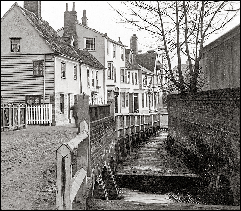
The Hare Bridge Spillway The spillway shown here might have been the last vestage of the brook which once flowed down church Street and met Robins Brook here. By the time this photo was taken, the water went the other way, when Robins brook flooded (as it often did) the spillway carried the floodwater across the Gravel and into a leet alongside (it's still there) this passed under Bridge Street and the iron foundry and emptied into the back ditch. The leet was probably originally built to supply the foundry, perhaps to drive a bellows or a hammer.
In my time (1950's & 60's) a raised footpath ran along the spillway which allowed pedestrians to cross the brook without walking in the road. All this was cleared away in 1989 when the road was widened, pavements laid and the culvert enlarged as part of a flood protection scheme which made the spillway (allegedly) redundant. A garden in memory of Brian Tebbutt now occupies part of the site and the nearby houses called Culvert Place commemorate some of this history.
Date: c1905
Ref: 47/20b
Also in: East & West St.
 |  |  |  |  |
 |  |  |  |  |
 |  |  |  |  |