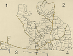
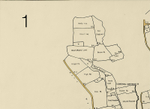
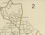
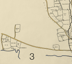
Coxall 1758
Great Coggeshall field names in 1758.
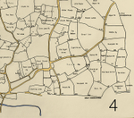
Includes Key Map and detailed views 1-4 and a view of the central area.
The field names are shown on a tracing I took in 1977 from a photograph of the 1758 map in the Essex Record Office ref T/M 230A.
The original map 'A survey of the Manor of Coggeshall otherwise Coggeshall Hall with the demesne, free, customary and tithable lands thereto belonging....' was made by T Skynner from a survey of 1753.
A digital copy of the original is available on the ERO website ref: T/M 230/16 although you need to be a CARN Ticket holder to view it. The original is in private hands and use of the digital image is prohibited.
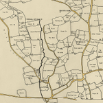
|
|
|
|
|
|